
Macedonia del Norte en autocaravana: regiones y rutas
Macedonia del Norte en autocaravana: regiones recomendadas, mejor época, acceso por carretera y consejos prácticos para planificar la ruta.
Published 18 de septiembre de 2026Last checked 19 de septiembre de 2026
Moneda
Denar
MKD, no el euro. 61.47 denares por €1 en septiembre de 2026
Idioma
Macedonio
Escrito en cirílico. El albanés se habla ampliamente en el oeste
Conducción
Derecha
Autopista 130 km/h, otras carreteras 90 km/h
Seguro
Lleva una tarjeta verde
No en el acuerdo de la UE. Muestre prueba en la frontera
Peajes
Sin viñeta
Peajes de barrera, pagaderos en denares o euros
Emergencia
112
Policía 192, ambulancia 194, ayuda en carretera 196
Áreas de Macedonia del Norte
Las regiones de Macedonia del Norte: un lago, dos cordilleras y un valle caliente
El país es pequeño y la altitud hace el trabajo. Ohrid, en el suroeste, es el centro de gravedad, el Šar y Mavrovo, en el noroeste, son las montañas, y el corredor del Vardar, en medio, es la carretera rápida y calurosa que conecta todo con Grecia y Serbia.

Ohrid y el lago
Ohrid y el lago: el centro de gravedad de todo el país
El lago Ohrid es uno de los lagos más antiguos del mundo, compartido con Albania, y la ciudad en su orilla noreste es un sitio de la UNESCO con iglesias, un anfiteatro y una fortaleza apilados en una ladera. A unos 690 metros, el lago modera el clima a su alrededor, por eso esta zona funciona en agosto cuando Skopje no lo hace.
Mejor en mayo, junio, septiembre y octubre
What it is like
- Cooler than the rest of the country. Ohrid averages 28 °C in July and August against Skopje's 32.
- The wettest month is November, not a summer one, which is the pattern nationwide.
Where to go
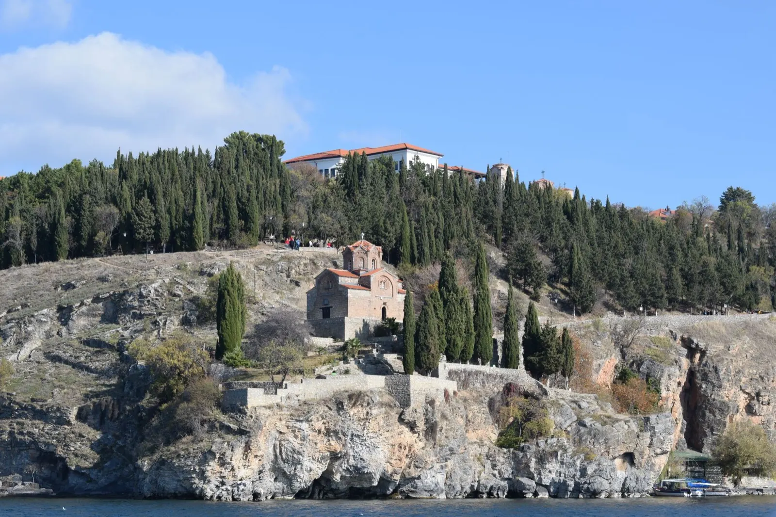
- Saint John at Kaneo, on its cliff
- Ohrid old town and the Samuel fortress
For the vehicle
- This is where the organised camps are. The lake shore has the highest concentration in the country, which matters because a camp is the only place the law permits camping.
- The Albanian border at Sveti Naum and Qafë Thanë is right here. Your green card needs both AL and MK.

Mavrovo y las montañas Šar
Mavrovo y las montañas Šar: el noroeste alto
El Parque Nacional de Mavrovo rodea un embalse a unos 1.200 metros, con el Korab, el pico más alto del país, en la frontera albanesa detrás. Al norte de este, la cordillera de Šar recorre la frontera con Kosovo. Esta es zona de esquí en invierno y el mejor lugar para caminar del país de junio a septiembre.
Mejor junio a septiembre
What it is like
- High and cold. There is no climate row for these mountains on this page because no station here publishes normals, but read them as far colder than Skopje at every time of year.
- The half-submerged church in Mavrovo lake is the photograph everyone takes.
Where to go
- Mavrovo lake and the sunken church
- Galičnik and its stone houses
For the vehicle
- Winter equipment is compulsory 15 November to 15 March, and up here that is not a formality.
- Mavrovo is a national park with its own protection regime, which this page has not read. Ask the park before you plan a night.

Skopie y el corredor del Vardar
Skopie y el corredor del Vardar: el rápido y caliente centro
Skopie se encuentra en una cuenca en el Vardar con el cañón Matka a su puerta, y el río fluye hacia el sur desde allí a través de Veles, Demir Kapija y Gevgelija hasta la frontera griega. Este es el corredor de la autopista, la parte más calurosa del país y donde están los peajes.
Mejor de abril a junio, septiembre, octubre
What it is like
- Hot and dry. Skopje averages 32 °C in July and August with under 40 mm of rain in either month.
- Thick fog from November to February in the Skopje basin, which also traps the winter air.
Where to go
- Matka canyon, twenty minutes from Skopje
- The old bazaar and Kale fortress
For the vehicle
- This is where you pay tolls. A tall two-axle van is class III: 290 denars from Demir Kapija to Gevgelija against 100 for a car.
- The Greek border at Bogorodica is a Schengen border, and the EU's Entry and Exit System is lengthening those queues in 2026.