
Belgio in camper: regioni e itinerari
Belgio in camper: regioni consigliate, stagione migliore, accesso stradale e suggerimenti pratici per pianificare l’itinerario.
Published 18 settembre 2026Last checked 19 settembre 2026
Valuta
Euro
EUR. Carte accettate ovunque. Bancontact è il circuito locale
Lingua
Olandese, Francese, Tedesco
Olandese nelle Fiandre, francese in Vallonia, entrambi a Bruxelles
Guida
Destra
Autostrada 120 km/h, 90 km/h oltre 3,5 tonnellate
Elettricità
230V, tipo E
La presa ha un perno di terra. Controlla il tuo cavo di collegamento
Acqua del rubinetto
Sicuro da bere
Richiedi kraantjeswater o eau du robinet
Emergenza
112
Polizia 101. Medico reperibile 1733
Aree del Belgio
Le regioni del Belgio: costa, città d'arte, capitale, fiume e foresta
Un paese che puoi attraversare in due ore cambia completamente lungo il percorso, da un muro di appartamenti sulla spiaggia a un altopiano forestale vuoto con la neve. Scegli la regione in base al mese e al set di regole con cui entri, perché in Belgio queste sono due domande diverse ed entrambe hanno risposte reali.

La costa fiamminga
La costa fiamminga: una lunga spiaggia, un tram e i parcheggi più severi del Belgio
L'intera costa belga è una singola striscia di sabbia che va da De Panne, al confine francese, a Knokke-Heist, a quello olandese, con un tram che la percorre per tutta la sua lunghezza. Ostenda, Blankenberge, Nieuwpoort e De Haan si trovano lungo questa costa, e le vere dune sopravvivono alle due estremità, nel Westhoek e allo Zwin.
Ideale a maggio, giugno e settembre
What it is like
- August is the warmest month at Ostend, with a mean daily maximum of 22 °C, and also one of the wettest at 84 mm.
- Much of the seafront is a wall of apartment blocks. The dunes at De Panne and Knokke are what the rest of it used to look like.
Where to go
- The Westhoek dunes at De Panne, the biggest dune area in the country
- The Zwin nature park at Knokke, for birds and salt marsh
For the vehicle
- Coastal communes are the strictest in Belgium on overnight parking, and each writes its own police regulation. Read the one for the town you stop in.
- Seafront car parks almost all carry height barriers, and the ones that do not fill by 10:00 in summer.

Le Fiandre e le città d'arte
Le Fiandre e le città d'arte: Bruges, Gand, Anversa e Lovanio a un'ora di distanza l'una dall'altra
Piatte, dense, di lingua olandese e fortemente ciclabili. Quattro città che sarebbero un viaggio a sé stante si trovano a un'ora di distanza l'una dall'altra: Bruges e i suoi canali, Gand e il suo castello, Anversa e il suo porto e i diamanti, Lovanio e la sua università. Tra di esse ci sono terreni agricoli, birra e i campi di battaglia del Westhoek.
Ideale da maggio a settembre
What it is like
- July and August average a daily maximum of 24 °C at Antwerp, which is as warm as Belgium gets outside a heatwave.
- The cities are built to be walked and cycled. Bruges in particular is hostile to anything larger than a car, by design.
Where to go
- Bruges, best very early or after the day trippers leave
- Ghent, the one the Flemish rate above Bruges
For the vehicle
- Antwerp and Ghent both run low emission zones, and a foreign plate has to be registered first. One free registration covers both.
- Ghent says a motorhome may park on the road but not be slept in, and points you at the Blaarmeersen campsite or the Driebeek camper terrain at 12 euros a day.

Bruxelles e Brabante
Bruxelles e Brabante: la capitale e la zona per cui devi registrarti
Diciannove comuni che compongono una regione urbana bilingue, circondata dal Brabante Fiammingo a nord e dal Brabante Vallone a sud. Ai margini: la Foresta di Sonian, un bosco di faggi patrimonio dell'UNESCO che inizia al capolinea del tram, il campo di battaglia di Waterloo e Lovanio con la più antica università dei Paesi Bassi.
Ideale da maggio a settembre
What it is like
- Uccle, the reference station for the country, averages a daily maximum of 23 °C in July and August and 6 °C in January.
- The Sonian Forest is the reason Brussels feels less landlocked than it is. It is large and it starts inside the region.
Where to go
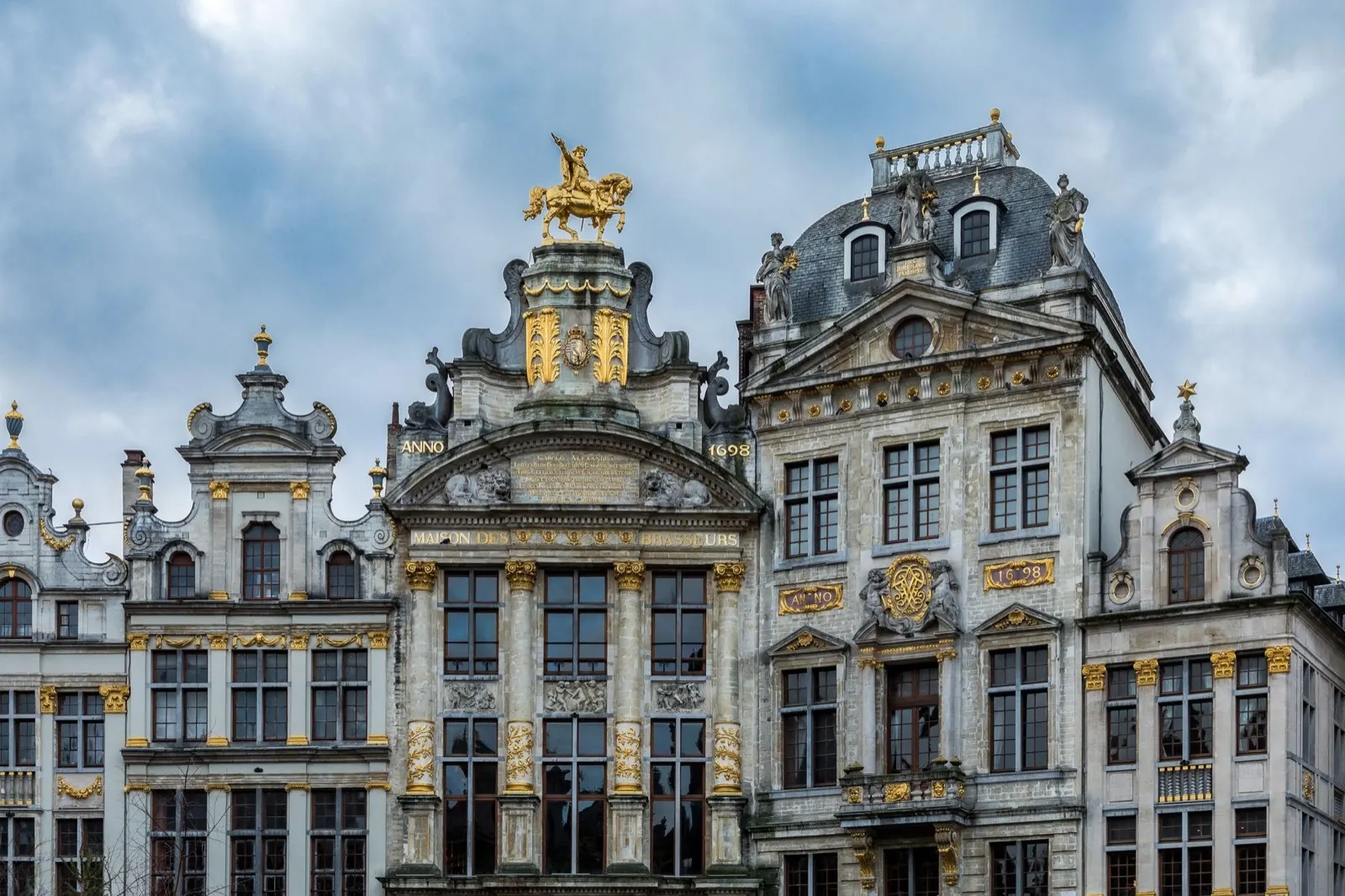
- The Grand Place, best at first light before the square fills
- The Sonian Forest, beech cathedral on the southern edge
For the vehicle
- The low emission zone covers all 19 communes, and a foreign plate must be registered, free, before you enter or within five days. Not doing it is 150 euros.
- Euro 5 diesel lost access on 1 January 2026. A day pass is 35 euros for a car or van, up to 24 a year.