
Serbia in camper: regioni e itinerari
Serbia in camper: regioni consigliate, stagione migliore, accesso stradale e suggerimenti pratici per pianificare l’itinerario.
Published 18 settembre 2026Last checked 19 settembre 2026
Valuta
Dinaro serbo
RSD, non l'euro. Da 117.05 a 117.75 din per €1 il 18 settembre 2026
Lingua
Serbo
Scritto sia in cirillico che in latino, entrambi ufficiali
Guida
Destra
Autostrada 130 km/h, altre strade 80 km/h
Elettricità
230V, tipo F
Stessa spina bipolare come la maggior parte dell'Europa
Acqua del rubinetto
Acqua di rete
I consigli sanitari del governo britannico per la Serbia non riportano avvertenze sull'acqua
Emergenza
112
Ambulanza 194. Soccorso stradale 1987
Aree della Serbia
Le regioni della Serbia: il Danubio, le montagne occidentali e l'est vuoto
La Serbia cambia forma mentre la attraversi. Il nord è una pianura pannonica con città austro-ungariche, l'ovest è una montagna boscosa, l'est è una gola che quasi nessuno percorre, e tutto pende da due valli fluviali e due corridoi autostradali.

Belgrado
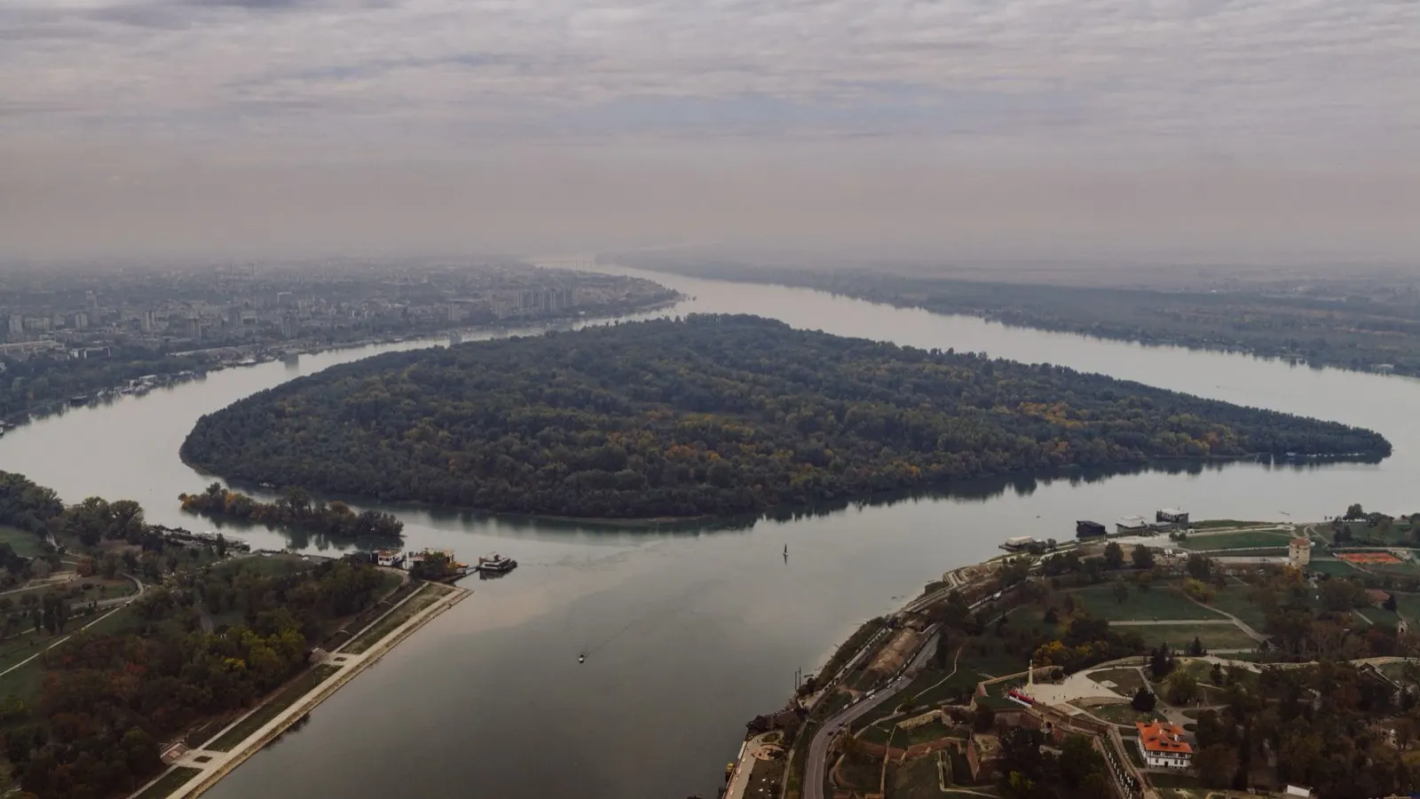
Belgrado: dove la Sava incontra il Danubio
Una grande, rumorosa, grezza capitale costruita nel punto in cui si incontrano due grandi fiumi, con una fortezza sul promontorio e una reputazione notturna che si guadagna. Tutto in Serbia passa da qui, e i due corridoi autostradali si incrociano alla tangenziale.
Ideale a maggio, giugno e settembre
What it is like
- Kalemegdan fortress sits on the confluence and is free to walk into.
- Skadarlija is the old tavern street, and Zemun across the Sava is the quieter, Austro-Hungarian half of the city.
Where to go
- Kalemegdan and the fortress walls
- Zemun quay and the Gardoš tower
For the vehicle
- Park on the edge and use the buses and trams. The centre is not a place to take a long van.
- The bypass carries toll on some sections, and category 4 vehicles have paid on it since 1 April 2026.

Vojvodina e il nord
Vojvodina: pianeggiante, austro-ungarica e la guida più facile in Serbia
La provincia autonoma a nord del Danubio: pianure coltivate piatte come una tavola, città pianificate con facciate gialle asburgiche e le migliori colline vinicole del paese a Fruška Gora. Ungherese, slovacco e rumeno sono in uso ufficiale accanto al serbo in alcune sue parti.
Ideale a maggio, giugno e settembre
What it is like
- Novi Sad is the second city, walkable, with the Petrovaradin fortress across the river.
- Subotica and Palić are art nouveau towns on the Hungarian border, and look it.
Where to go
- Novi Sad and Petrovaradin fortress
- Sremski Karlovci for wine and the old seminary town
For the vehicle
- Belgrade to Subotica on the E75 was 1,270 dinars in toll category 2 on the July 2026 tariff.
- Flat, straight roads and small villages. The easiest part of the country to drive a long vehicle.

Serbia occidentale
Serbia Occidentale: Tara, Zlatibor e il Drina
Paese montuoso boscoso tra il Drina e l'Ibar, e la parte della Serbia dove i serbi stessi vanno in estate. Tara è un parco nazionale con un ripido canyon di pini sopra il Drina, Zlatibor è un altopiano aperto di prati e villaggi a circa mille metri.
Ideale da giugno a settembre
What it is like
- Zlatibor averages 24 C in July and August against Belgrade's 30, which is the whole reason it fills up.
- It is also the wettest part of the country in early summer, with over 100 mm in May, June and July.
Where to go
- Tara national park and the Drina canyon viewpoints
- Zlatibor plateau and its village roads
For the vehicle
- The Ibarska magistrala to the south of here is named by UK government advice as particularly dangerous. Take it slowly or take the E763.
- Tara is a national park, so the manager's internal-order rules govern what you can do on its land.