
Svizzera in camper: regioni e itinerari
Svizzera in camper: regioni consigliate, stagione migliore, accesso stradale e suggerimenti pratici per pianificare l’itinerario.
Published 18 settembre 2026Last checked 18 settembre 2026
Valuta
Franco svizzero
CHF, non l'euro. 0.9462 franchi per €1 il 18 settembre 2026
Lingue
Tedesco, Francese, Italiano
Il rumantsch è la quarta lingua nazionale
Guida
Destra
Autostrada 120 km/h, superstrada 100, altre strade 80
Elettricità
230V, tipo J
Una spina Schuko di solito non entra. Porta un adattatore
Autostrada
Vignetta CHF 40
Un adesivo, tutta la rete, fino a 3,5 t
Emergenza
112
Polizia 117, ambulanza 144, soccorso aereo 1414
Regioni della Svizzera
Le regioni della Svizzera: sei percorsi, tre lingue e due chilometri di altitudine
La Svizzera è abbastanza piccola da attraversarla in un giorno e abbastanza varia da far cambiare lingua, tempo e regole mentre lo fai. Scegli la regione per altitudine e mese, e lascia che i passi decidano l'ordine in cui percorrerli.

Vallese
Vallese: l'angolo più secco della Svizzera e quello con il Cervino
La valle del Rodano scorre da est a ovest tra le due pareti montuose più alte delle Alpi, e le valli laterali si innalzano da essa verso Zermatt, Saas-Fee e il Grand Combin. Il francese è parlato nella valle inferiore, il tedesco in quella superiore, e il confine tra le due si trova intorno a Sierre.
Da aprile a giugno, settembre e ottobre
What it is like
- The driest region in this guide. Sion gets less rain in a year than any other station in the strip.
- Terraced vineyards on the north slope and glaciers directly above them.
Where to go
- Zermatt and the Gornergrat, parked at Täsch
- The Aletsch glacier from the Riederalp side
For the vehicle
- Caravans and tents outside an authorised campsite need a building permit here once they stand more than three weeks or number more than twelve.
- The Lötschberg car train drops you into the Valais from the Bernese Oberland in minutes, all year.

Oberland Bernese
L'Oberland Bernese: il volto della montagna che tutti immaginano
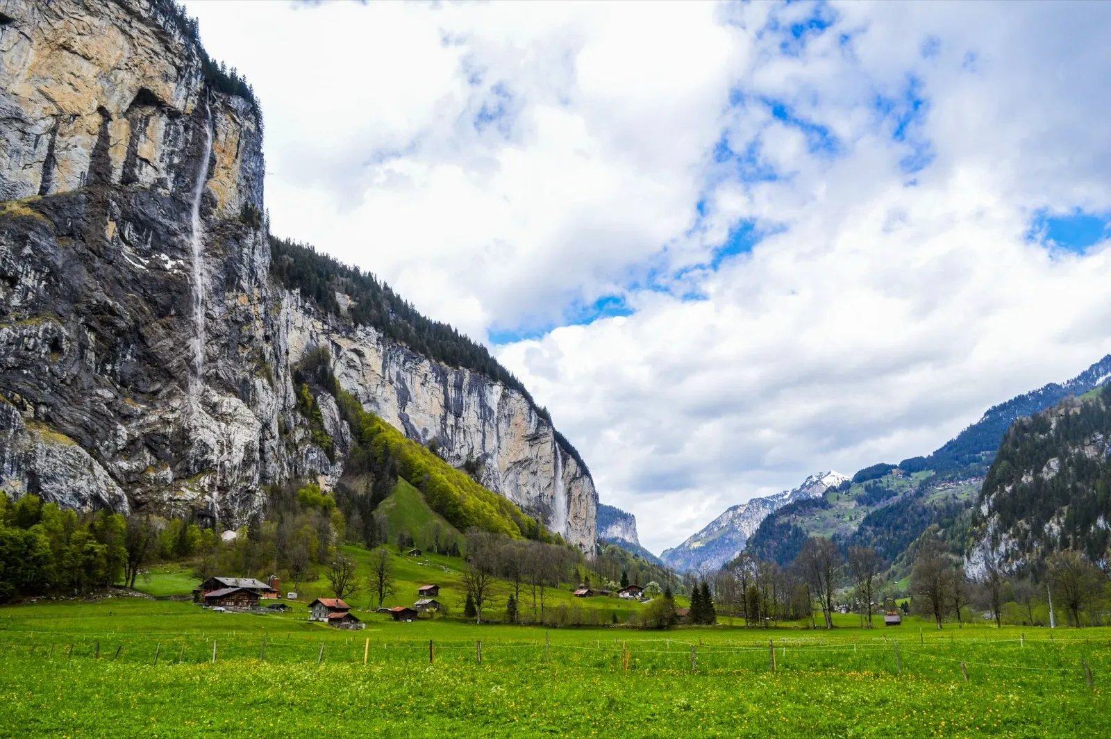
Interlaken si trova tra due laghi con l'Eiger, il Mönch e la Jungfrau che si ergono dietro di essa, e le valli di Lauterbrunnen e Grindelwald si estendono fino a essi. Questo è il paesaggio montano più visitato del paese e il più organizzato.
Ideale da giugno a settembre
What it is like
- Wet. Interlaken's summer months are among the rainiest in the strip, which is exactly why the valleys are so green.
- The Lauterbrunnen valley has a vertical wall on both sides and dozens of waterfalls coming off them.
Where to go
- Lauterbrunnen and the Staubbach falls
- Grindelwald and the walks under the Eiger north face
For the vehicle
- Free and wild camping is banned in the canton's listed wildlife protection areas, and several of them are in these mountains.
- Mürren and Wengen are car free. Park in the valley and take the train.

Grigioni e l'Engadina
I Grigioni e l'Engadina: il cantone più grande, le valli più alte
Il cantone più grande della Svizzera, trilingue in tedesco, italiano e romancio, e l'unico con un parco nazionale. L'Engadina si estende per circa 1.700 metri per tutta la sua lunghezza, il che la rende fredda, luminosa e il posto migliore del paese in cui trovarsi ad agosto.
Ideale da giugno a settembre
What it is like
- High. Samedan's January daily maximum is below freezing and its July maximum is 19 °C.
- Romansh is still a living language in these valleys and appears on signs alongside German.
Where to go
- The Swiss National Park along the Ofen pass road
- The Engadin lakes between St Moritz and Maloja
For the vehicle
- No general cantonal rule on overnighting could be found here. Communal signs are the only source, and the National Park area is strict.
- Inside the national park the only overnight options are the Cluozza hut and Hotel Il Fuorn.