
Bosna a Hercegovina obytným autom: najlepšie regióny a trasy
Bosna a Hercegovina obytným autom: odporúčané regióny, najlepšie obdobie, prístupové cesty a praktické tipy na plánovanie trasy.
Published 18. septembra 2026Last checked 19. septembra 2026
Mena
Konvertibilná marka
BAM, nie euro. Pevný kurz 1.95583 KM za €1
Jazyky
Bosniančina, Chorvátčina, Srbčina
Latinka a cyrilika v používaní
Jazda
Vpravo
Diaľnica 130 km/h, ostatné cesty 80 km/h
Poistenie
Zelená karta nie je potrebná
EÚ kontroly ukončené 19. októbra 2020
Míny
775 km² stále podozrivé
Zostaňte na cestách a vyznačených chodníkoch
Tiesňová linka
112
Ambulancia 124
Oblasti Bosny a Hercegoviny
Regióny Bosny a Hercegoviny: hory, dve rieky a stredomorský chvost
Toto je krajina dolín a doliny rozhodujú o všetkom: kadiaľ vedú cesty, kde sú mestá, aké je počasie a ako dlho trvá každá cesta. Vnímajte to skôr ako štyri alebo päť riečnych systémov než ako mapu a predĺžte každý čas jazdy o polovicu.

Sarajevo a centrum
Sarajevo a centrum: mesto v kotline a hory nad ním
Sarajevo sa nachádza v úzkej kotline vo výške asi 500 metrov s horami na každej strane a olympijské vrcholy Bjelašnica, Igman a Jahorina sú vzdialené do hodiny. Je to najkoncentrovanejšie miesto v krajine: osmanský bazár, habsburské bulváre, socialistické bloky a stopy obliehania, v pešej vzdialenosti od seba.
Najlepšie od mája do začiatku októbra
What it is like
- Proper seasons. 28 °C in August, 4 °C in January, and rain spread through the year rather than in a wet season.
- The bowl traps air in winter, and air pollution here is a real and officially flagged problem.
Where to go
- Baščaršija and the Latin Bridge
- The tunnel museum under the airport
For the vehicle
- Thefts from cars have increased around Sarajevo, particularly on Mount Trebević. Leave nothing visible and park where there are people.
- The A1 runs north from here and charges a campervan 14 KM to Zenica north against 7 for a car.

Bosna a Hercegovina
Hercegovina: Mostar, Neretva a krasový juh
Južne od razvodnice sa zemljom se potpuno menja: goli krš, smokve i vinova loza, i mediteranska klima koja se proteže sve do Trebinja i hrvatske granice. Mostar je njen centar, a Neretva je razlog zašto se išta nalazi tamo gde se nalazi.
Najlepšie od apríla do júna a v septembri a októbri
What it is like
- Hot. Mostar averages 33.5 °C in August and the karst holds the heat well past sunset.
- Wet in late autumn rather than in summer, and the November figures here are higher than Sarajevo's.
Where to go
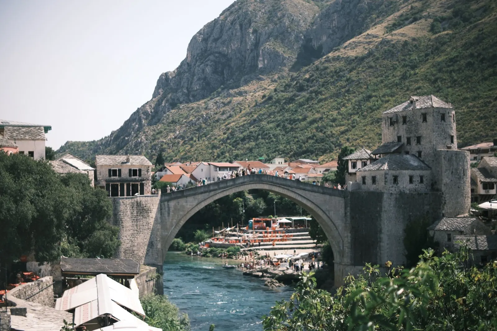
- Mostar and the Old Bridge, early or late
- Blagaj, where the Buna comes out of a cliff
For the vehicle
- This is the Federation, so the hospitality law and its 50 to 500 KM camping fine apply here.
- Diving off the Mostar bridge has caused serious injuries and deaths. It is not a thing to try.

Una a severozápad
Una a severozápad: najzelenšia voda v krajine
Una sa dvíha neďaleko chorvátskych hraníc a preteká na sever cez Martin Brod, Kulen Vakuf a Bihać cez kaskádu travertínových vodopádov. Národný park Una chráni to najlepšie z nej a celý kút je pripravený na rafting, čo znamená, že je pripravený aj na kempingy.
Najlepšie od mája do septembra
What it is like
- The wet corner of the country. Bihać takes over 100 mm in most months, which is why the river looks the way it does.
- Cooler than the rest in summer, at 27 °C in July against Mostar's 33.
Where to go
- Štrbački buk, the big fall in the national park
- Martin Brod and the Una Kruna cascades
For the vehicle
- This was a front line, and it is one of the parts of the country where staying on made surfaces matters most.
- The rafting bases are the easiest legal places to sleep, and they know which ground is cleared.