
Švajčiarsko obytným autom: najlepšie regióny a trasy
Švajčiarsko obytným autom: odporúčané regióny, najlepšie obdobie, prístupové cesty a praktické tipy na plánovanie trasy.
Published 18. septembra 2026Last checked 18. septembra 2026
Mena
Švajčiarsky frank
CHF, nie euro. 0.9462 franku za €1 dňa 18. septembra 2026
Jazyky
Nemčina, Francúzština, Taliančina
Rómantština je štvrtý národný jazyk
Jazda
Vpravo
Diaľnica 120 km/h, rýchlostná cesta 100, ostatné cesty 80
Napájanie
230V, typ J
Zástrčka Schuko sa zvyčajne nezmestí. Prineste si adaptér
Diaľnica
Diaľničná známka 40 CHF
Jedna nálepka, celá sieť, až 3,5 t
Tiesňová linka
112
Polícia 117, ambulancia 144, letecká záchranná služba 1414
Oblasti Švajčiarska
Regióny Švajčiarska: šesť jázd, tri jazyky a dva kilometre nadmorskej výšky
Švajčiarsko je dostatočne malé na to, aby ste ho prešli za deň, a dostatočne rozmanité na to, aby sa počas cesty menil jazyk, počasie a pravidlá. Vyberte si región podľa nadmorskej výšky a mesiaca a nechajte priesmyky rozhodnúť o poradí, v akom ich prejdete.

Valais
Valais: najsuchší kút Švajčiarska a ten s Matterhornom
Údolie Rhôny sa tiahne od východu na západ medzi dvoma najvyššími horskými masívmi Álp a bočné údolia stúpajú z neho k Zermattu, Saas-Fee a Grand Combin. V dolnom údolí sa hovorí po francúzsky, v hornom po nemecky a hranica medzi nimi je približne pri Sierre.
Najlepšie od apríla do júna a v septembri a októbri
What it is like
- The driest region in this guide. Sion gets less rain in a year than any other station in the strip.
- Terraced vineyards on the north slope and glaciers directly above them.
Where to go
- Zermatt and the Gornergrat, parked at Täsch
- The Aletsch glacier from the Riederalp side
For the vehicle
- Caravans and tents outside an authorised campsite need a building permit here once they stand more than three weeks or number more than twelve.
- The Lötschberg car train drops you into the Valais from the Bernese Oberland in minutes, all year.

Bernské Alpy
Bernské Alpy: horská tvár, ktorú si každý predstaví
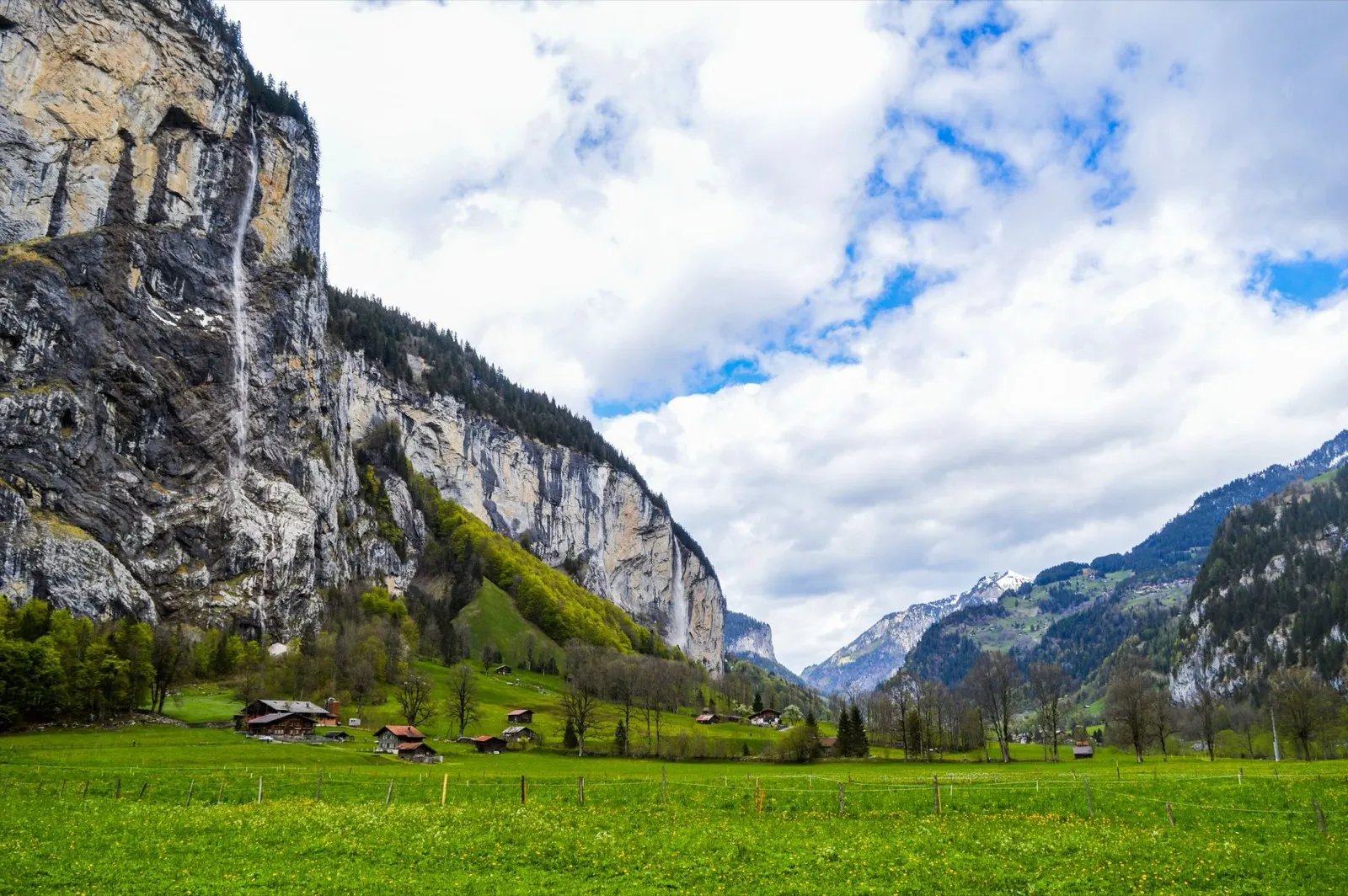
Interlaken sa nachádza medzi dvoma jazerami s dominantami Eiger, Mönch a Jungfrau v pozadí, zatiaľ čo do nich siahajú doliny Lauterbrunnen a Grindelwald. Ide o najnavštevovanejšiu horskú krajinu v krajine a zároveň najviac organizovanú.
Najlepšie od júna do septembra
What it is like
- Wet. Interlaken's summer months are among the rainiest in the strip, which is exactly why the valleys are so green.
- The Lauterbrunnen valley has a vertical wall on both sides and dozens of waterfalls coming off them.
Where to go
- Lauterbrunnen and the Staubbach falls
- Grindelwald and the walks under the Eiger north face
For the vehicle
- Free and wild camping is banned in the canton's listed wildlife protection areas, and several of them are in these mountains.
- Mürren and Wengen are car free. Park in the valley and take the train.

Graubünden a Engadin
Graubünden a Engadin: najväčší kantón, najvyššie doliny
Najväčší kantón Švajčiarska používa nemčinu, taliančinu a rétorománčinu a ako jediný má národný park. Engadin leží po celej dĺžke približne vo výške 1,700 metrov, takže je chladný, slnečný a v auguste patrí k najlepším miestam v krajine.
Najlepšie od júna do septembra
What it is like
- High. Samedan's January daily maximum is below freezing and its July maximum is 19 °C.
- Romansh is still a living language in these valleys and appears on signs alongside German.
Where to go
- The Swiss National Park along the Ofen pass road
- The Engadin lakes between St Moritz and Maloja
For the vehicle
- No general cantonal rule on overnighting could be found here. Communal signs are the only source, and the National Park area is strict.
- Inside the national park the only overnight options are the Cluozza hut and Hotel Il Fuorn.