
North Macedonia by campervan: best regions and routes
Where to go by campervan in North Macedonia: recommended regions, the best season, road access and practical route advice.
Published 18 September 2026Last checked 19 September 2026
Currency
Macedonian denar
MKD, not the euro. 61.47 denars to €1 in September 2026
Language
Macedonian
Written in Cyrillic. Albanian is widely spoken in the west
Driving
Right
Motorway 130 km/h, other roads 90 km/h
Insurance
Carry a green card
Not in the EU arrangement. Show proof at the border
Tolls
No vignette
Barrier tolls, payable in denars or euros
Emergency
112
Police 192, ambulance 194, road help 196
Areas of North Macedonia
The regions of North Macedonia: a lake, two mountain ranges and a hot valley
The country is small and the altitude does the work. Ohrid in the south west is the centre of gravity, the Šar and Mavrovo in the north west are the mountains, and the Vardar corridor in between is the fast, hot road that connects everything to Greece and Serbia.

Ohrid and the lake
Ohrid and the lake: the centre of gravity of the whole country
Lake Ohrid is one of the oldest lakes in the world, shared with Albania, and the town on its north east shore is a UNESCO site of churches, an amphitheatre and a fortress stacked up a hillside. At about 690 metres the lake moderates the climate around it, which is why this corner works in August when Skopje does not.
Best May, June, September, October
What it is like
- Cooler than the rest of the country. Ohrid averages 28 °C in July and August against Skopje's 32.
- The wettest month is November, not a summer one, which is the pattern nationwide.
Where to go
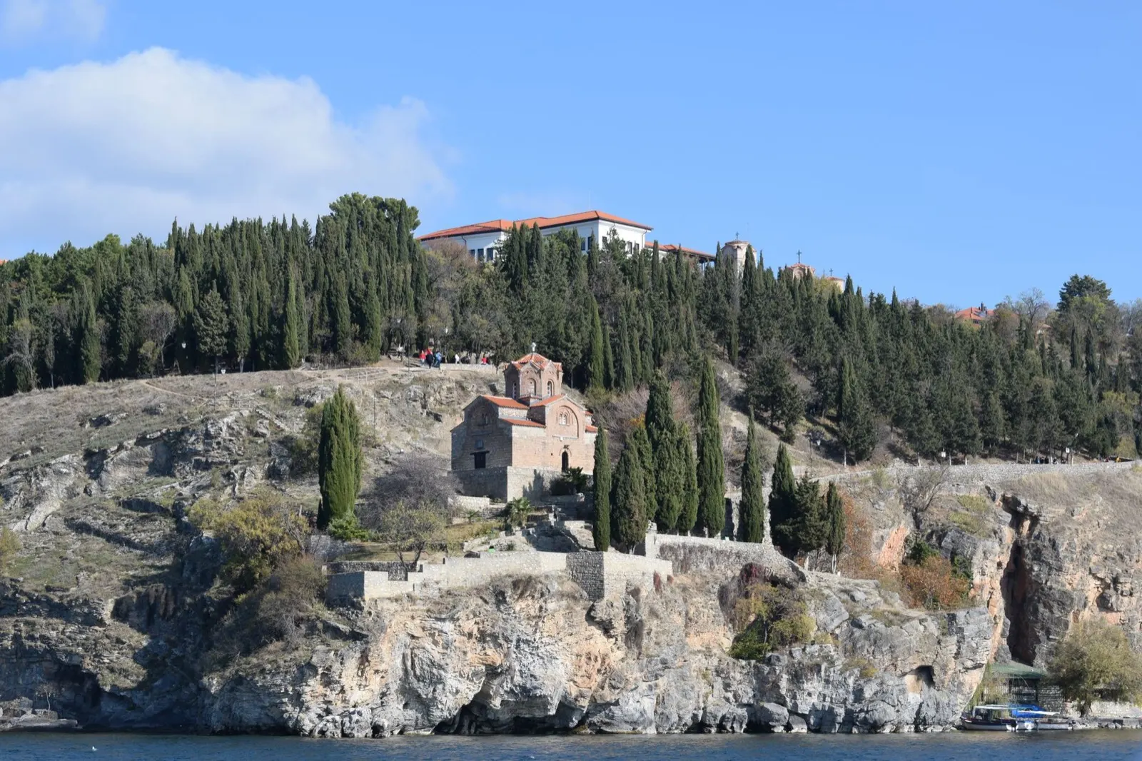
- Saint John at Kaneo, on its cliff
- Ohrid old town and the Samuel fortress
For the vehicle
- This is where the organised camps are. The lake shore has the highest concentration in the country, which matters because a camp is the only place the law permits camping.
- The Albanian border at Sveti Naum and Qafë Thanë is right here. Your green card needs both AL and MK.

Mavrovo and the Šar mountains
Mavrovo and the Šar mountains: the high north west
Mavrovo National Park wraps around a reservoir at about 1,200 metres with Korab, the highest peak in the country, on the Albanian border behind it. North of that the Šar range runs along the Kosovo border. This is ski country in winter and the best walking in the country from June to September.
Best June to September
What it is like
- High and cold. There is no climate row for these mountains on this page because no station here publishes normals, but read them as far colder than Skopje at every time of year.
- The half-submerged church in Mavrovo lake is the photograph everyone takes.
Where to go
- Mavrovo lake and the sunken church
- Galičnik and its stone houses
For the vehicle
- Winter equipment is compulsory 15 November to 15 March, and up here that is not a formality.
- Mavrovo is a national park with its own protection regime, which this page has not read. Ask the park before you plan a night.

Skopje and the Vardar corridor
Skopje and the Vardar corridor: the hot fast middle
Skopje sits in a basin on the Vardar with the Matka canyon on its doorstep, and the river runs south from it through Veles, Demir Kapija and Gevgelija to the Greek border. This is the motorway corridor, the hottest part of the country and where the tolls are.
Best April to June, September, October
What it is like
- Hot and dry. Skopje averages 32 °C in July and August with under 40 mm of rain in either month.
- Thick fog from November to February in the Skopje basin, which also traps the winter air.
Where to go
- Matka canyon, twenty minutes from Skopje
- The old bazaar and Kale fortress
For the vehicle
- This is where you pay tolls. A tall two-axle van is class III: 290 denars from Demir Kapija to Gevgelija against 100 for a car.
- The Greek border at Bogorodica is a Schengen border, and the EU's Entry and Exit System is lengthening those queues in 2026.